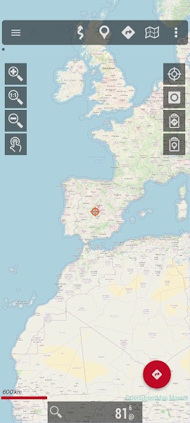
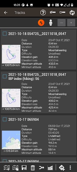
OruxMaps GP is a powerful mapping and navigation app available for Android devices. It offers a wide range of features for outdoor enthusiasts, hikers, bikers, and other users who rely on GPS navigation. With detailed offline maps, customizable waypoints, tracks, and routes, OruxMaps GP is the ideal companion for exploring the great outdoors.
 |
 |
Features
One of the key features of OruxMaps GP is its extensive range of maps. Users can download offline maps for various regions and countries, allowing them to navigate without an internet connection. The app supports popular map sources such as OpenStreetMap, Google Maps, and others, giving users the flexibility to choose the best map for their needs.
- Map download.
- 3D view.
- Text to Speech (some locales).
- Wms support.
- Support to some .rmap maps.
- Support to vector maps (mapsforge).
- Support to vector Garmin .img maps (not locked).
- Profiles.
- Save/restore preferences.
- Complete track statistics, with different graphs.
- External bluetooth GPS support.
- Export your tracks in KML/GPX/KMZ formats.
- Follow your old tracks/routes, with distance alarm.
- Save Waypoints with attached photo-audio-video media files. Wpt proximity alarm with custom audio alarm.
- Waypoint navigation mode.
- Geocaching support.
- Custom cursor images.
- Power save mode, for long track recording.
- Use a heart monitor with your device (supported Zephyr HRM, Polar Bluetooth and ANT+).
- Upload/download tracks from everytrail.com.
- Upload tracks to gpsies.com, mapmytracks.com and trainingstagebuch.org.
- Live tracking with mapmytracks.com.
OruxMaps GP also allows users to customize their maps with waypoints, tracks, and routes. Users can mark important locations, plot their routes, and record their tracks to easily navigate back to their starting point. The app supports various file formats for importing and exporting waypoints, tracks, and routes, making it easy to share data with other users.
In addition to its mapping features, OruxMaps GP offers advanced navigation tools such as compass and GPS tracking. Users can view their current location, speed, altitude, and other relevant data in real-time, helping them stay on course and reach their destination safely. The app also includes features like distance measuring, waypoint navigation, and track recording to enhance the user experience.
User Interface
OruxMaps GP has a user-friendly interface that is easy to navigate and customize. Users can adjust the map view, zoom in and out, and switch between different map sources with just a few taps. The app also offers various tools for managing waypoints, tracks, and routes, allowing users to organize their data efficiently.
The app's interface is designed to be intuitive and responsive, ensuring a smooth user experience. Users can easily access all the app's features and settings from the main menu, making it easy to plan their outdoor adventures and navigate with confidence. Whether you're a beginner or experienced user, OruxMaps GP makes it easy to explore the great outdoors with its user-friendly interface.
Conclusion
Overall, OruxMaps GP is a versatile mapping and navigation app for Android that offers a wide range of features for outdoor enthusiasts. With detailed offline maps, customizable waypoints, tracks, and routes, the app provides everything you need to explore the great outdoors with confidence. Whether you're hiking, biking, or simply exploring a new area, OruxMaps GP is the perfect companion for all your outdoor adventures. Download the app today and start exploring the world around you with OruxMaps GP.


